News

GIS Training Closure
April 2, 2026
IMC Successfully Concludes GIS Capacity Building Training for Line Ministries The Somaliland Information Management Centre (IMC) successfully concluded a week-long Geographic Information Systems (GIS) Capacity Building Training, held at the IMC Hall in Hargeisa. The training brought together technical staff from key line ministries and national institutions, with the objective of strengthening their practical skills in geospatial data analysis, mapping, and the application of GIS tools in decision-making processes. Throughout the program, participants engaged in hands-on sessions covering core GIS concepts, spatial data handling, and real-world applications relevant to land, water, and environmental management. The training emphasized practical use cases to support institutional planning, monitoring, and reporting functions. The program concluded with a certificate award ceremony, where all participants were recognized for their active participation and successful completion of the training. This initiative reflects IMC’s ongoing commitment to: - Strengthening technical capacity across government institutions - Promoting the use of geospatial data for evidence-based decision-making - Enhancing coordination and data sharing among national stakeholders By investing in capacity development, IMC continues to play a central role in advancing data-driven planning and sustainable resource management across Somaliland.
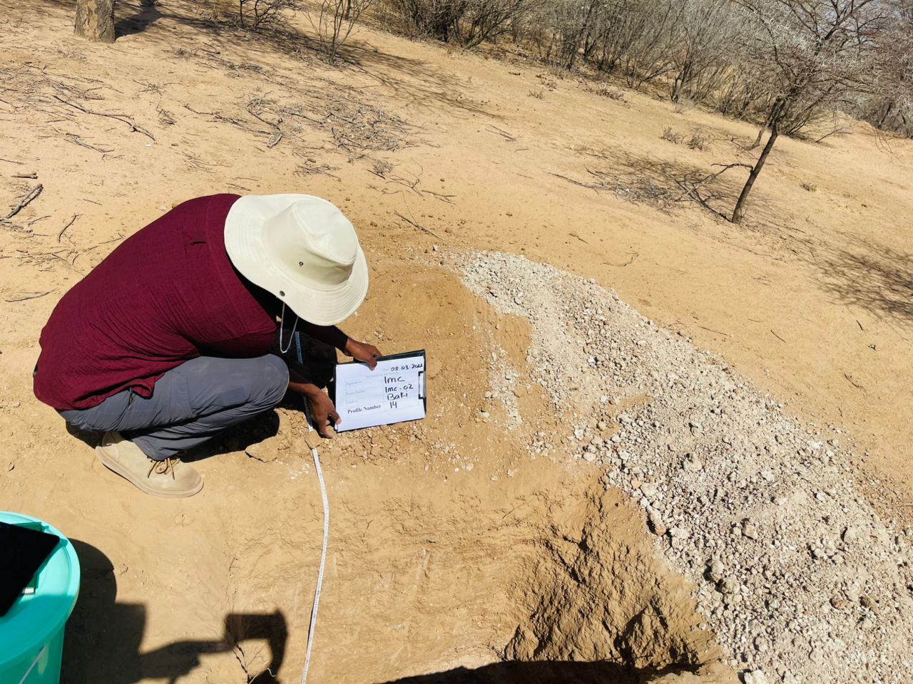
Soil Sampling and Profiling Study in Baki District to Support Sustainable Agriculture
March 8, 2026
The Information Management Centre (IMC) for Land and Water, in collaboration with the FAO-SWALIM programme and relevant line ministries, conducted a soil sampling and soil profiling field mission in the agricultural areas of Baki District, Awdal Region, Somaliland. The mission aimed to generate critical soil data to support sustainable land management, climate-smart agriculture, and evidence-based agricultural planning. Baki District is an important agricultural production zone where farmers rely primarily on rain-fed and semi-irrigated farming systems. However, the area is increasingly affected by soil fertility decline, land degradation, and climate variability, which pose risks to agricultural productivity and food security. The field study involved systematic soil sampling and soil profile assessments to analyze soil characteristics, land capability, and soil fertility conditions. The collected data will be further analyzed through laboratory testing and geospatial analysis using GIS tools to develop practical recommendations for improved land management. The outcomes of this initiative will contribute to establishing a baseline soil database for Baki District, supporting informed decision-making for farmers, policymakers, and development partners working toward sustainable agriculture and environmental resilience in Somaliland.
Field Mission: Gabiley Region | Soil Degradation & Erosion Assessment
Oct. 21, 2025
Recently, our IMC technical team undertook a mission in Gabiley focusing on ground-truthing soil degradation and erosion levels within the pilot watershed. 🌱 The mission aimed to validate our remote sensing and GIS-based soil degradation maps through on-the-ground data collection—identifying types of erosion, soil conditions, vegetation cover, invasive species mapping, and local drivers of land degradation. 👷♂️ We collected detailed georeferenced field data capturing evidence of sheet, rill, and gully erosion and documenting real impacts on farmland and rangeland ecosystems. This effort contributes to strengthening data-driven decision-making for soil conservation and sustainable land management across Somaliland.
- 1
- 2